
Portfolio Details
Precipitation Downscaling using Machine Learning in Google Earth Engine
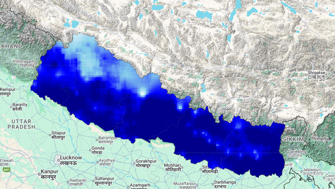
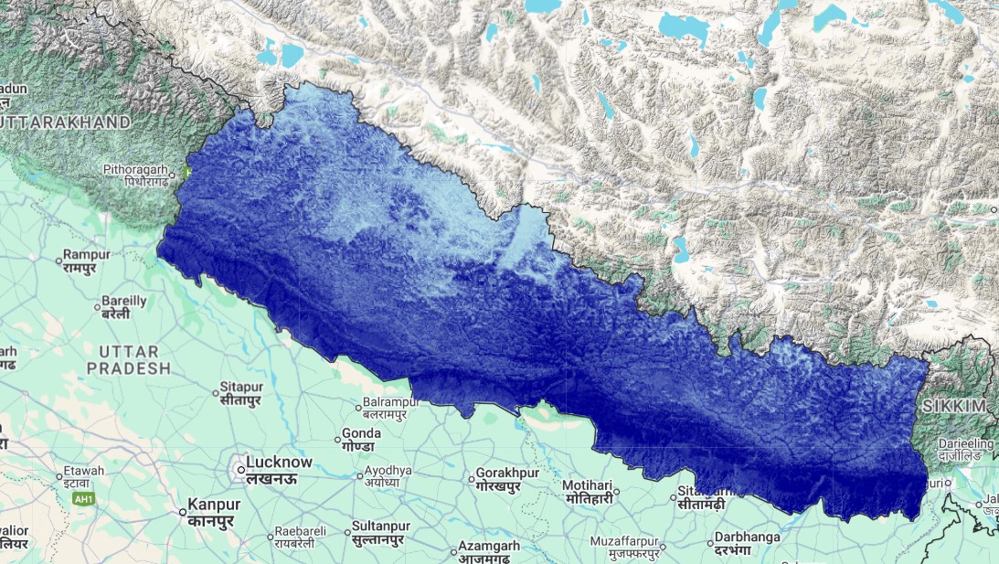
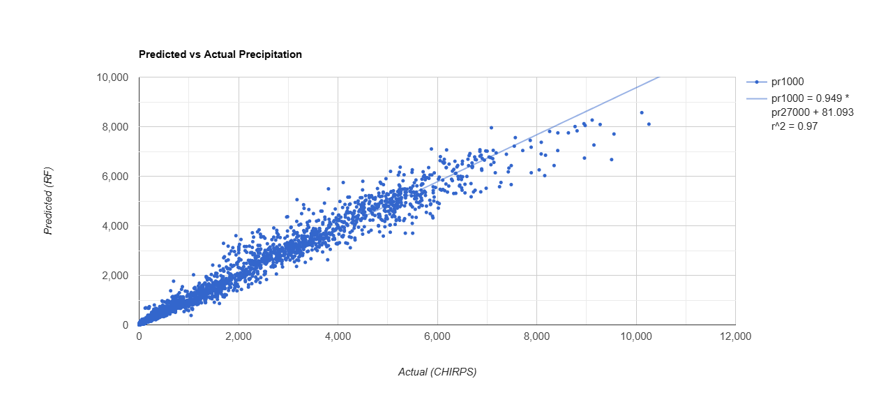
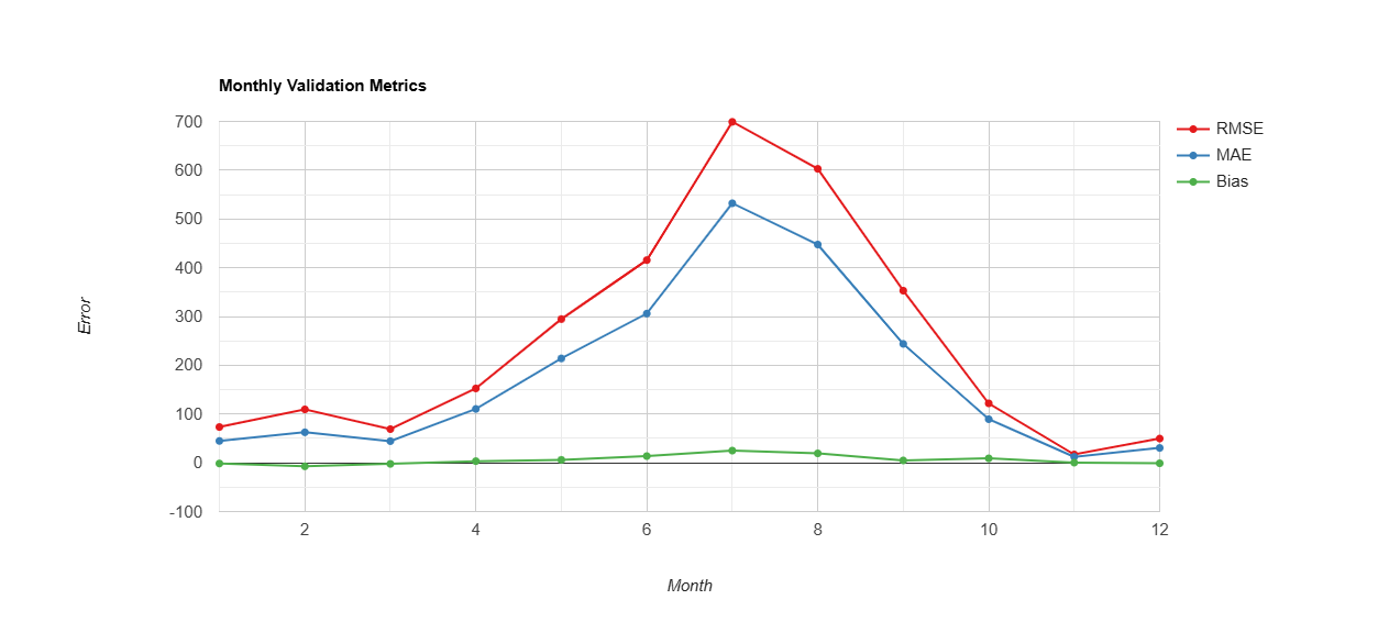
This project downscaled coarse-resolution CHIRPS rainfall data to a finer spatial resolution (~1 km) using a Random Forest regression model. I combined topographic (DEM, slope, aspect), land cover, NDVI, and temperature data to estimate monthly precipitation from 2000 to 2012. The model showed high accuracy, with strong correlation between predicted and actual values (R² = 0.97). Validation charts revealed that most errors were concentrated in the peak monsoon months—an expected challenge due to extreme rainfall variability. This analysis is a part of methodology of my research work. This work supports more localized hydrological modeling, water resource planning, and climate studies in data-scarce mountain regions.