Portfolio Details
Species Distribution Model: Red Panda
- Date: 2024
- Members: Anup Kc, Milan Dhakal
- Funding: Red Panda Network & Deepjyoti Youth Club
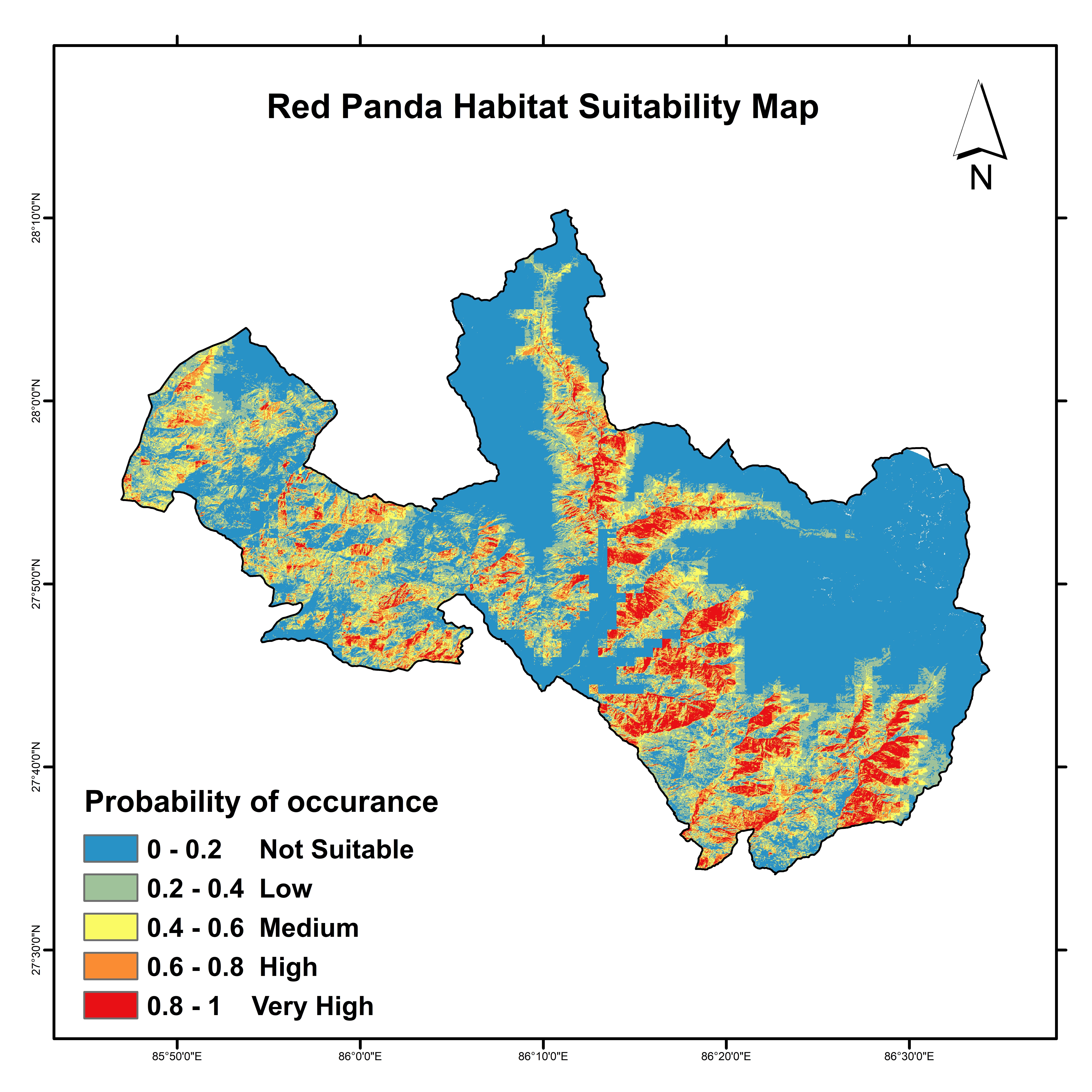
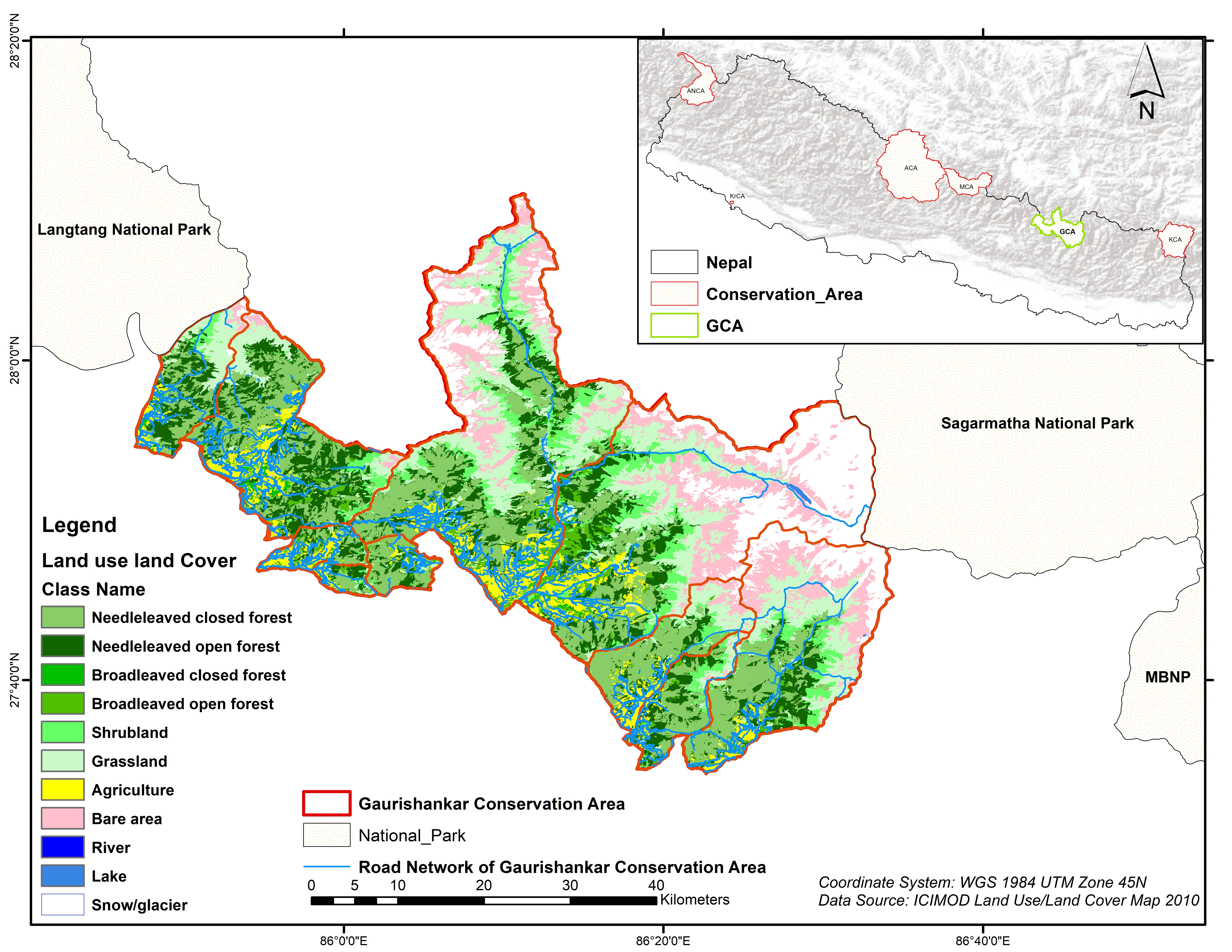
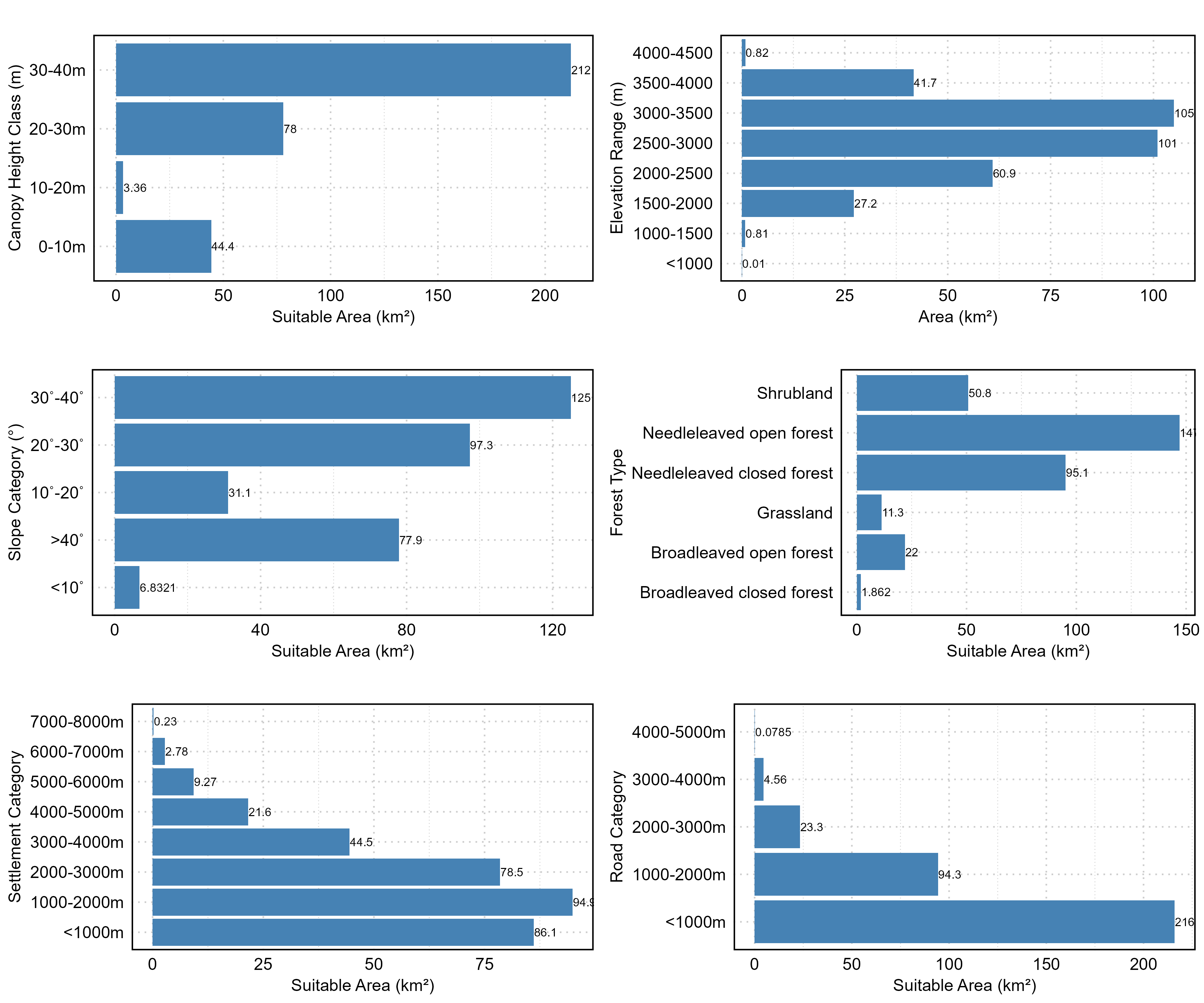
The study assessed red panda habitat suitability using data from transect surveys and remote sensing information on environmental factors, including bioclimatic, topographic, vegetation-related, and disturbance variables. Habitat modeling was performed with MaxEnt under three different scenarios. The study found NDVI and LULC to be key factors influencing habitat suitability. The model performed well, achieving an AUC of 0.86 and a TSS of 0.66. The GCA region has an estimated 337.17 km² of suitable habitat for red pandas, though the extent varies among local administrative units. About 102.54 km² of potential habitat lies within Gaurishankar Rural Municipality. The analysis showed that the most suitable areas are those with slopes of 30–40˚, covering 125 km², and elevations between 3000 and 3500 meters, covering 105 km². The largest habitat area, 147 km², was found in needle-leaved open forest, with needle-leaved closed forest covering the second largest at 95.1 km².


